 John Ferrell
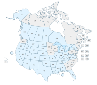
WellDatabase vs SONRIS
This post is the first in a series comparing the state oil & gas information sites to WellDatabase. We will not only compare the two but give a quick...


The industry didn't start with unconventionals and neither does our data. We cover the full historical dataset across every producing state and province. Don't settle for inferior data, check out our coverage for any state or province you're interested in.
This is the next state we come to in our series comparing the state oil & gas information sites to WellDatabase. We will continue to compare the two, as well as give a quick rundown on utilizing both systems. Hopefully along the way you will see what makes WellDatabase special as well as learn a little about how to use the existing state resources.
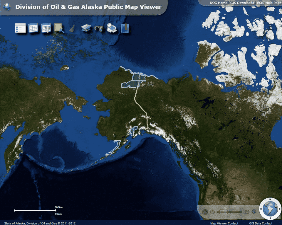
This is our second post in regards to Alaska. Our first gave a comprehensive look at the tools provided by Alaska’s Division of Oil and Gas. Now we will look at how we can use Welldatabase.com to look at the oil and gas data in Alaska.
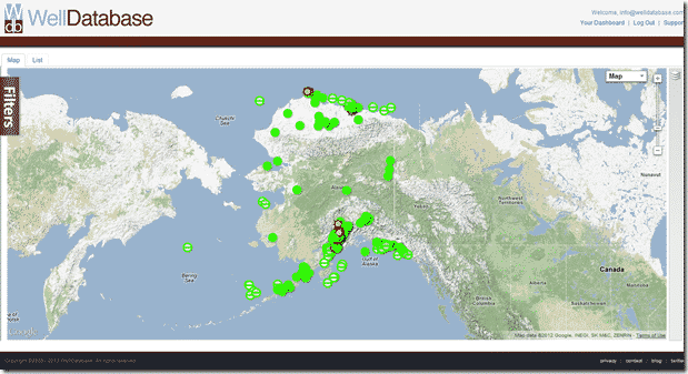
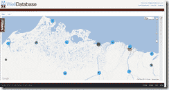
When first opening the map in WellDatabase you may notice that Alaska is either not visible or only partially visible depending on your screen size and resolution. With our site being dedicated to such a large area, we default to the area and zoom level that gives the most information available. One other thing you may notice if Alaska is  partially visible is that the cluster has a smaller number of wells that it seems like it should. The clusters are based on the visible area and the number of wells listed in the cluster is the number of wells in the state that are in the visible window. If we pan over to Alaska, we will get the entire picture. Once over the state of Alaska, you may also notice that there are two different clusters. This is because API information breaks down Alaska and Alaska offshore as two different state codes. One unique thing you can do with WellDatabase is search for just the
 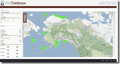 Alaska offshore wells and map those. To do that, we will open the filter panel, click on the state filter under the Geographic section. There we can type in Alaska and we will get the option to pick either Alaska or Alaska Offshore. Once we pick Alaska Offshore, we automatically get a full map of the offshore wells. For the sake of this example though, we will remove that filter and delve into the data in the Prudhoe Bay area.
 As we start to zoom into the north slope area we can see the familiar WellDatabase clusters appearing, giving us a good idea of the well distribution. The Prudhoe Bay area stands out as there is a cluster of over 5000 wells in that area. In WellDatabase, clicking on the cluster gives you the option to zoom into the area that makes up that particular cluster. If we click on the cluster of 5311 wells, we see that it is in fact a cluster of all wells in
 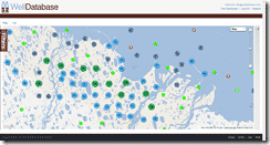 Beechey Point, Alaska. When we click the option to zoom to cluster, we are given a view of that area where we can further see the well distribution. The ability to see the data from a high level and easily navigate into areas of interest is one of the most powerful features of WellDatabase
From here we will pick a cluster of wells and once again zoom in close. Now Alaska has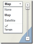 it’s wellbores clustered much closer than most places so we will have to remove the terrain layer of the Google map
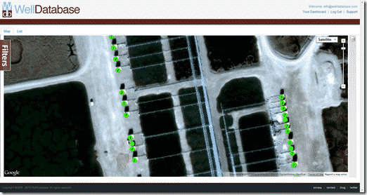 in order to zoom into the detail we need. This can easily be done by clicking on the map dropdown and unchecking the terrain checkbox. This will substantially increase the level in which you can zoom. We can now zoom in and look at the detail.

We can take a second here and use the same map dropdown to jump to the satellite view. This is especially interesting in Alaska where you can see all of the wellheads and the pipelines.
You may notice that some of the well spots have numbers much like the Alaska GIS application and when you click on them, they pop out in a similar fashion. Unlike the Alaska site, you can click on any of the individual well spots that popped out and view the different well information.
The information balloon pops out of the center of the actual well spot, but the data does change based on the well you click.
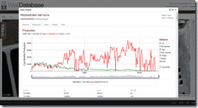
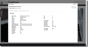 So now instead of having to jump to a different system like the Alaska site requires, we simply have to click on the details link and we are presented with the…well, details. For most of the wells in Alaska, WellDatabase has basic header information, production data, core, and history information.
 There are also thousands of wells with LAS log files in Alaska. WellDatabase contains a full featured LAS log viewer for premium users that easily opens and views these files. Back on the main map view, we will open the filter panel and simply check the Has Logs filter. Here are the results on the map:

Much like the other state sites, Alaska does a good job of pulling together data but lacks in the areas of usability and functionality. WellDatabase once again proves it’s value by putting the data together in an extremely easy to use package with an unparalleled feature set.
Take a minute and sign up at WellDatabase to experience the difference yourself.
This post is the first in a series comparing the state oil & gas information sites to WellDatabase. We will not only compare the two but give a quick...
This is the next state we come to in our series comparing the state oil & gas information sites to WellDatabase. We will continue to compare the two,...
WellDatabase and NuTech Energy Alliance, LTD are proud to announce the allignment of their platforms to combine the best interpreted subsurface...