 Joshua Holt
Searching WellDatabase
Over the past few months, we have received a good amount of questions in regard to searching WellDatabase. We understand some of the confusion given...


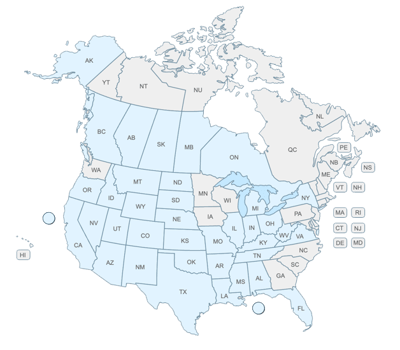
The industry didn't start with unconventionals and neither does our data. We cover the full historical dataset across every producing state and province. Don't settle for inferior data, check out our coverage for any state or province you're interested in.
The Q1 2021 Release is packed with new features most of which have come from direct feedback from our customer. In this blog we will take a quick look at all of the new bits, and then we will dig in deeper on follow up posts. If you have a question about a particular feature, please feel free to contact us at support@welldatabase.com, we are always here to help!
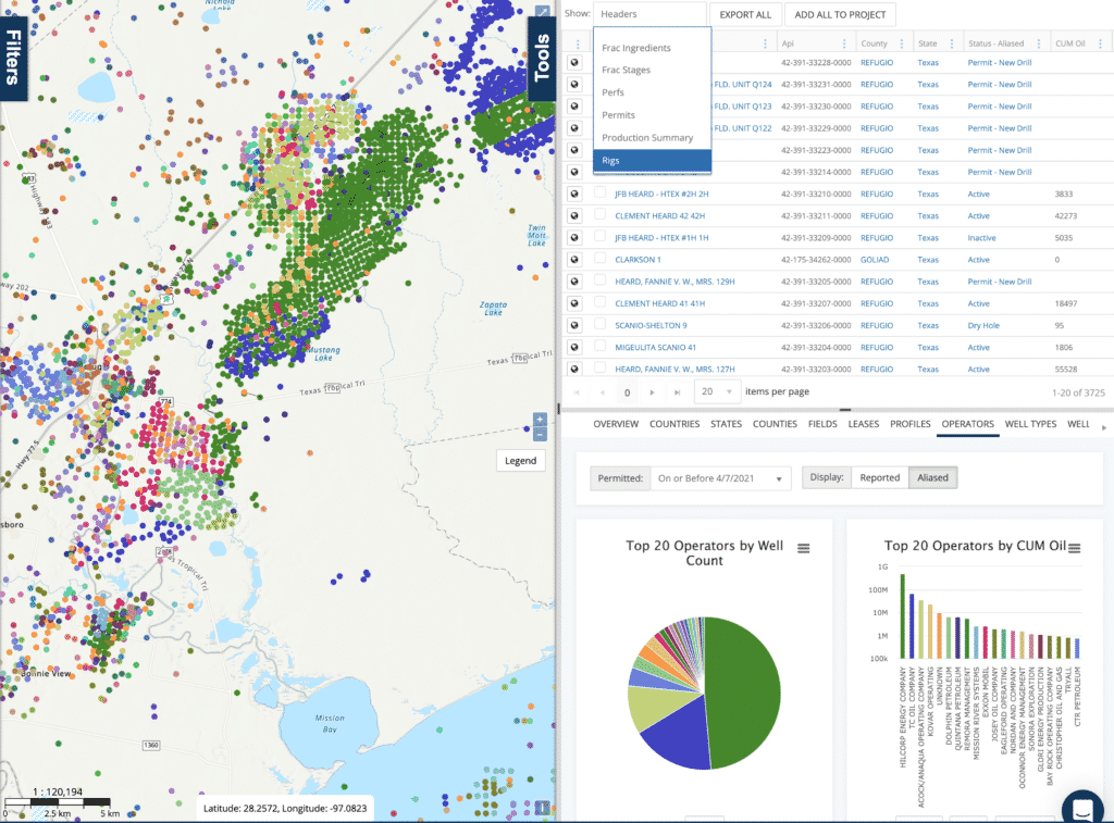
The biggest change in the Q1 2021 release is the move away from Google maps to a new mapping engine. The new interface supports all of the same features of our previous interface, and adds additional features like:
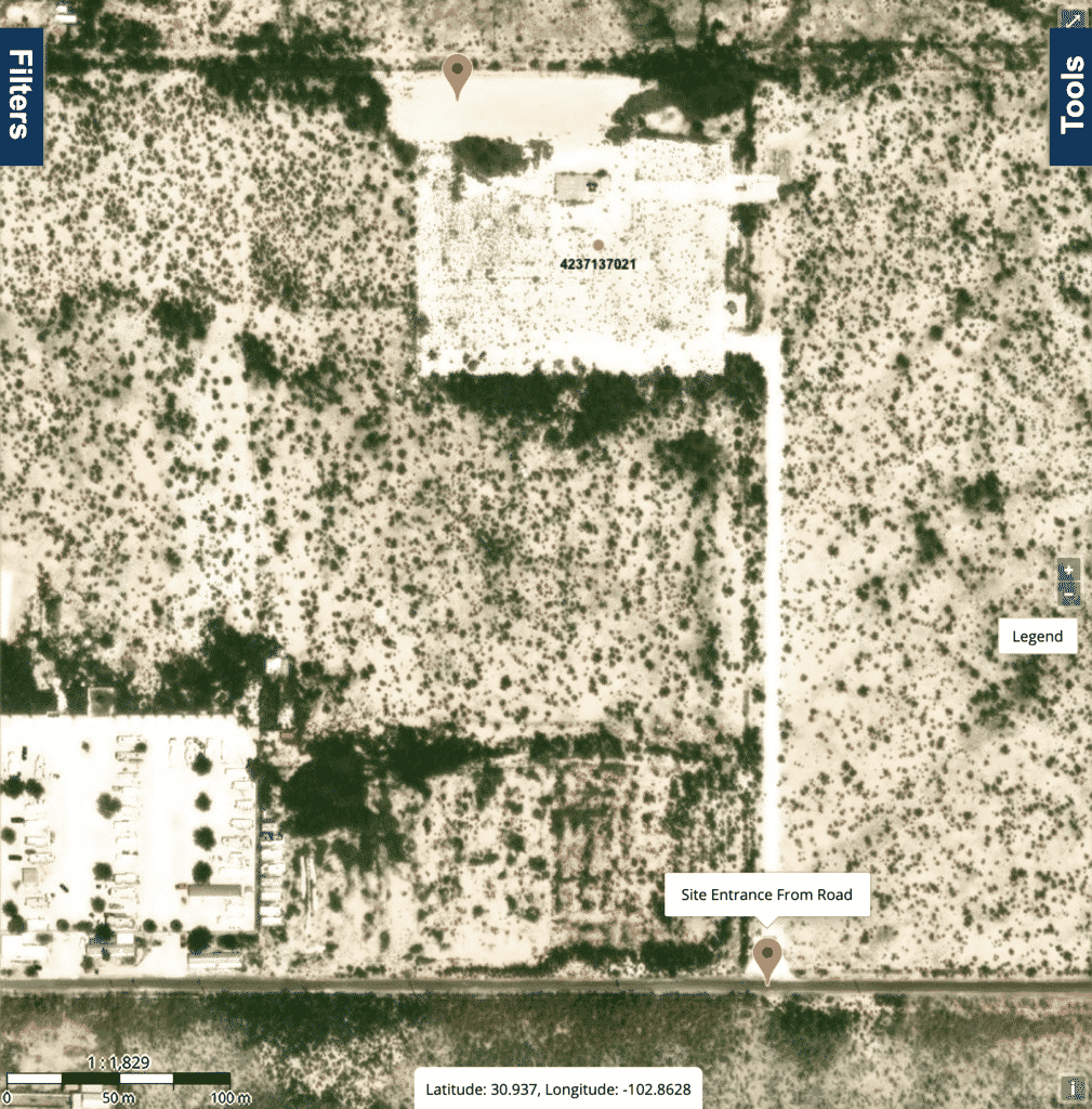
When we set out to move maps, we dug in deep looking for the best base map tiles we could find for our users. In the end, we decided on ESRI base maps. Their maps are the most complete road maps hands down, in many cases they even show lease roads not available in other providers!
Google Roadmap
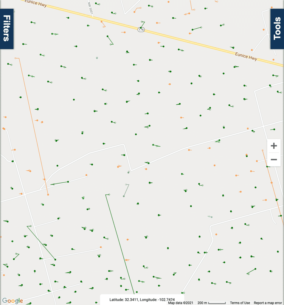
This shows the Google maps road map, the road through the middle doesn’t actually exist in the Satellite imagery.
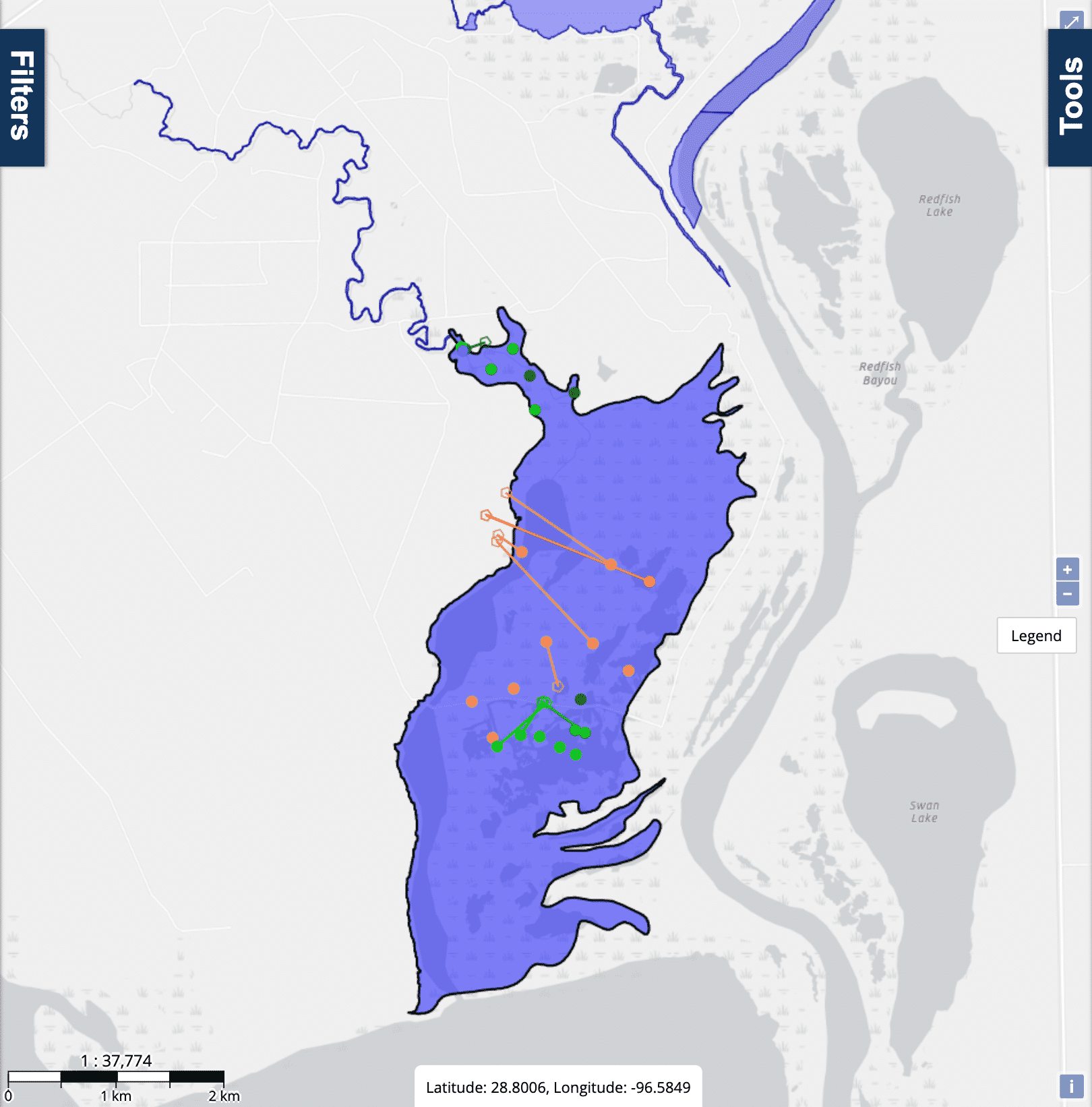
ESRI Roadmap
This image shows our new ESRI based roadmap, they show all the lease roads unlike the Google version.
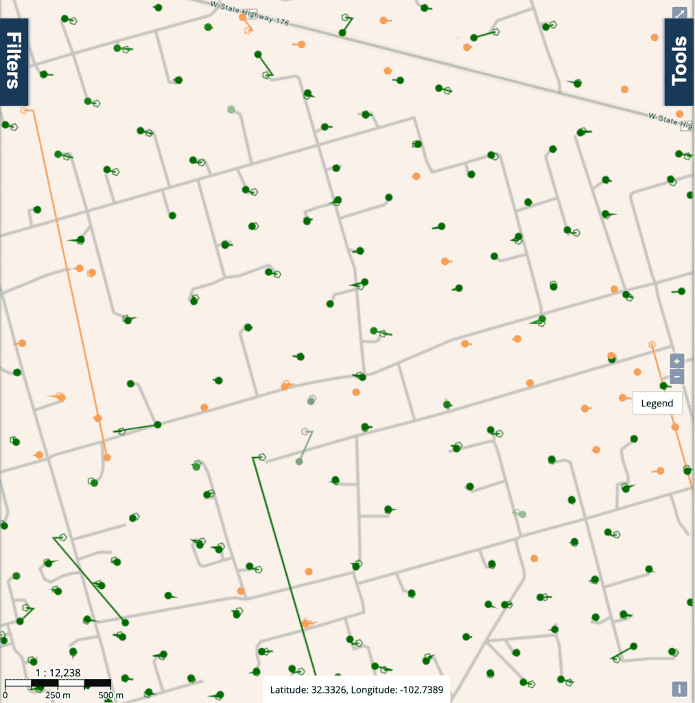
Actual Satellite
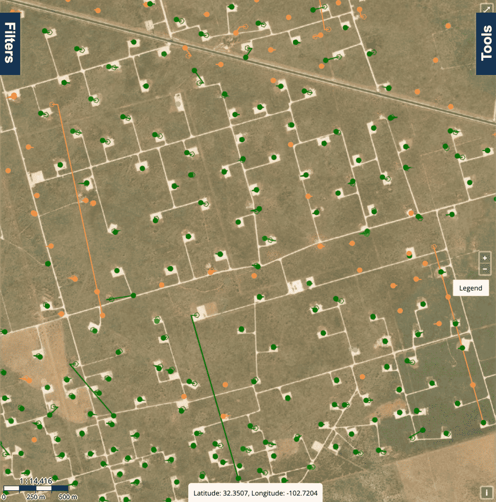
As you can see from this Satellite image, the ESRI road map lines up much better with the roads that actually exist.
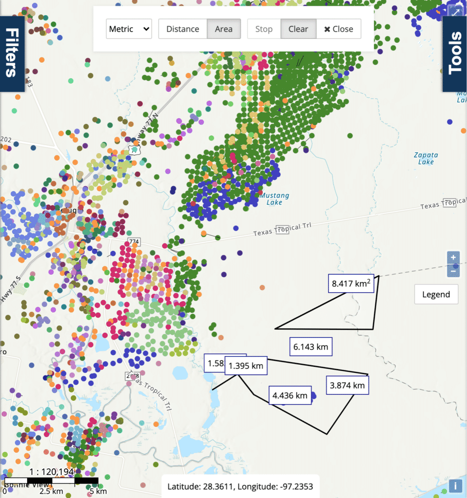
The new measure tool allows users to measure area, and distance on the WellDatabase map. Additionally you can choose between Metric and Imperial units. For a full run down take a look at Using the Measure Tool.
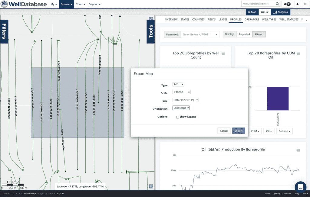
The new print tool allows you to export the map view to PDF or Image. The much requested ‘Print to Scale’ option is now available here as well! When the print tool opens, a selection box will display on the map to preview which area will be in the print based on the scale, and paper size settings. For a deep dive, check out Printing the Map.
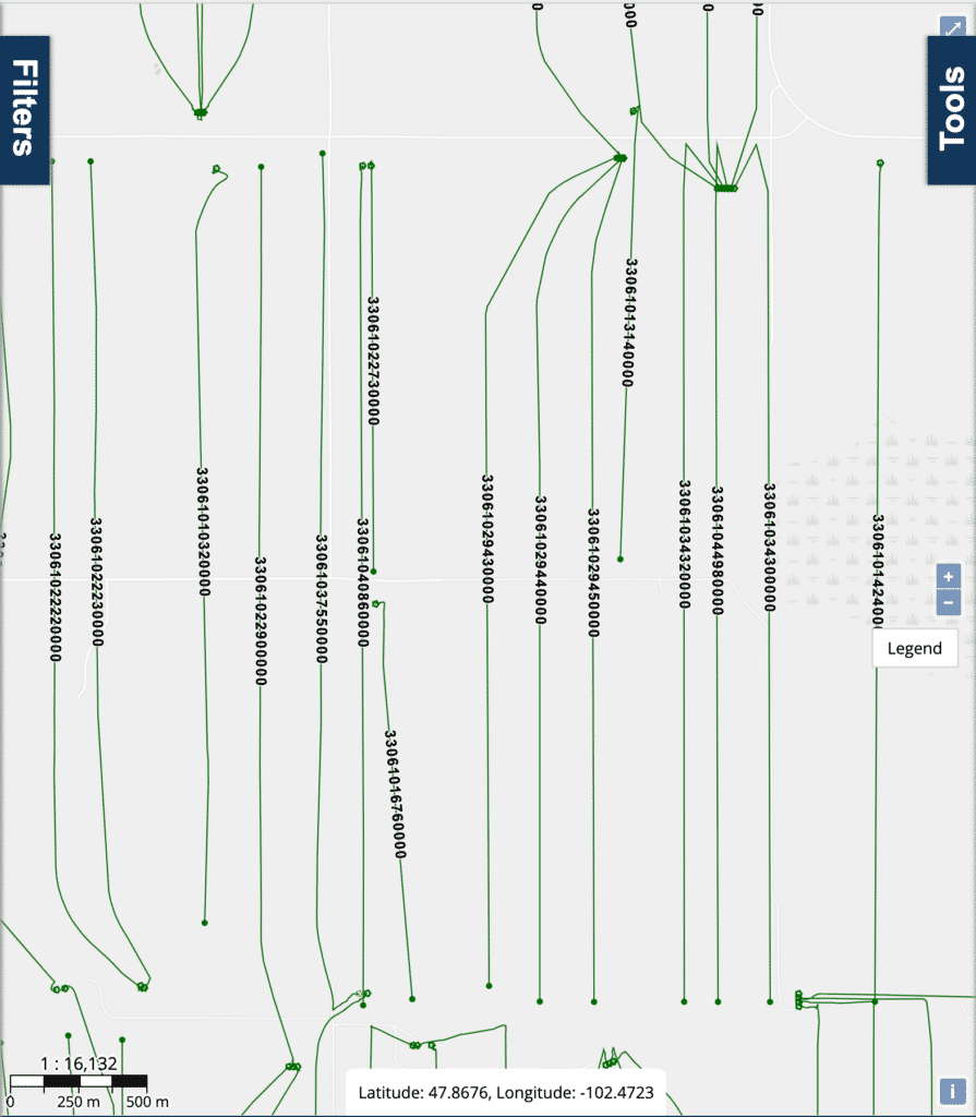
We have always provided the ability to display labels around the BHL on our map, but many users expressed the desire to place the labels directly on the lateral (when there is one). This update allows end users to place labels on the lateral when available, when there is not a lateral, it will be rendered at the BHL location like it is be default today.
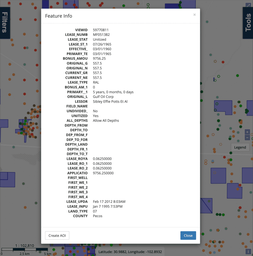
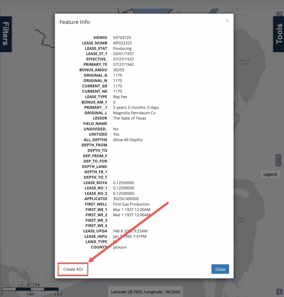
Overlays created by loading a KML, GeoJson, or Shapefile (including dbf) can now be clicked on directly. When you click on these items, the WellDatabase map will open a dialog showing all the attributes associated to that shape in the source file.
Example Shapefile:
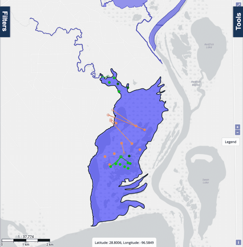
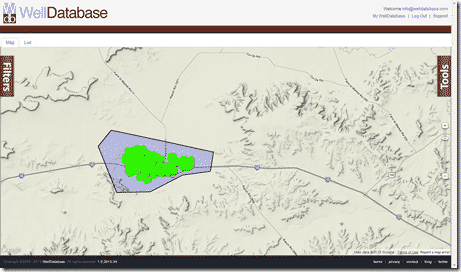
This is possibly one of the most requested features on our roadmap. The much anticipated feature has finally shipped in this release, and allows you to take any shape from your shapefile, and convert it to an AOI. Briefly, the quickest way to do this is:
Add a new Shapefile, KML, or GeoJson overlay.
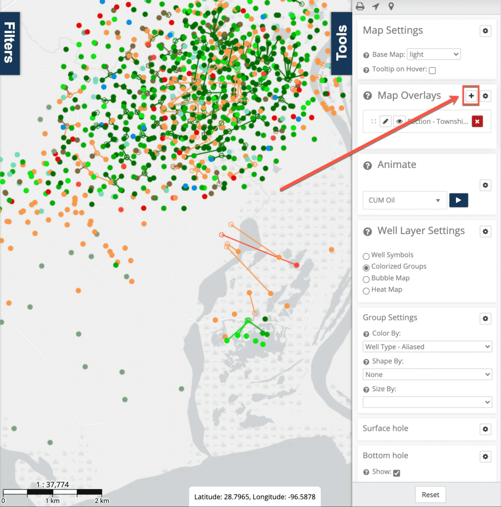
Left click on any of the loaded shapes, and select Create AOI in the lower left corner.
This will apply the selected shape as an AOI filter
Adding labeled markers makes it easy for you to customize the map with your own POIs. We will be adding additional features here soon, so please share any feedback you have with the team!
We strive to provide the most robust oil & gas dataset on the market, as such, we add new data types from time to time, and this release is no exception.
This release we have added:
These items are available in the list data type selector:
In previous releases, api users could only filter a child type by its own properties. In this release users can now apply header filters to any child type. This makes it easy for users to grab all the data for a specific set of wells based on any criteria in the header.
This update makes these examples possible: Ex: All casing data for wells in Texas only
Ex: All production forecasts data for wells in ND, Permitted in the last 10 years, operated by a specific operator.
For a long time our export system only exported SHL and BHL when a user exported a trajectory shapefile. With this release the actual trajectory is now exported for Shapefiles. Additionally, users can now export the Well Known Text of the trajectory when using CSV or Excel Exports.
We also shipped a few preview features, which will see a full release later in the year. If you are interested in trying any of these, please get in touch with support and we will put you on the preview list.
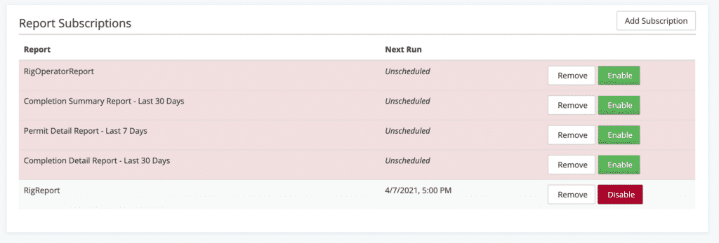
Love it or hate it, this is an often asked for feature in modern applications. The team still has some tweaks to make before we ship it to all users, but it is coming along nicely!
The report scheduler lets you configure report subscription which will be generated, and delivered directly to your inbox on a configured schedule.
This list covers the highlights of what we released in Q1 2021, stay tuned for follow up posts about how you can leverage these new features in your workflows! If you haven’t already, sign up for a WellDatabase account today, and try out the new bits. If you need a new trial, contact support and we will get you set up.
Over the past few months, we have received a good amount of questions in regard to searching WellDatabase. We understand some of the confusion given...
WellDatabase and NuTech Energy Alliance, LTD are proud to announce the allignment of their platforms to combine the best interpreted subsurface...
The team at OG Trust Services, LLC (“OGTS”) has relied on WellDatabase for years, but not we are proud to partner with them to integrate...